
Shafter
- Stay Informed
- News
- Events
Events
Engaging the public throughout the development and implementation of AB 617 will be paramount. The District plans to host a series of workshops, public meetings, and community forums to educate the public, yet more importantly, to solicit suggestions and feedback on a wide variety of issues, including allocation of funds, identifying communities for potential enhanced monitoring and action plan development.
See all AB 617 Related EventsUpcoming Events
Regular District Meetings
Related Workshops
- Funding
Funding
AB 617 and the recent Cap and Trade extension legislation is expected to bring significant additional funds to the Valley to help reduce emissions and improve public health in disadvantaged communities. Learn about qualifying projects, impacted communities and investment priorities.
Read About AB 617 FundingGrants Program
The District also administers an existing comprehensive incentive-based grants program to reduce emissions throughout the San Joaquin Valley.
- Contact
Contact
You can contact the Valley Air District about any AB617 related issues or questions.
559-230-6000
AB 617 Management Contacts
Ask for Stephanie Ng, Sarah Hasan Lane or Heather Heinks
Shafter Steering Committee meetings and information
Sign up to get email notificationsTrack Shafter Progress
Follow Up on CSC Meeting Action Items
Shafter Running Action ItemsDistrict Board Approved CERP
- CERP:
ENGLISH ESPAÑOL - CERP Documents:
- Appendix A: Community Outreach Materials
- Appendix B: Steering Committee Charter
- Appendix C: Source Apportionment and Community Inventories
- Appendix D: Public Resource: Existing Control of Air Pollution Sources of Concern to the Community
- Appendix E: Facility Risk Reduction Audits Under AB 2588: Facility Reassessment Status
- Appendix F: Enforcement Plan Attachments
- Appendix G: Health Impacts of Air Pollution
- Appendix H: Comment Letters
- Appendix I: Comments and Responses
Emissions Sources
 May not work in older browsers (Ex: Internet Explorer)
Resources
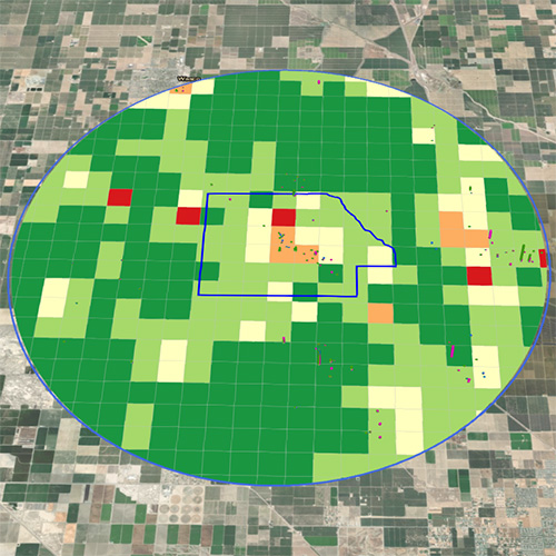
Boundary Map- Overall Mobile and Area-wide emission sources summary of PM2.5, VOC, NOx emissions, and air toxicsENGLISH ESPAÑOL
- On-road mobile sources emissions summary of additional air toxicsENGLISH ESPAÑOL
- Off-road mobile sources emissions summary of additional air toxics ENGLISH ESPAÑOL
- Area-wide sources emissions summary of additional air toxics ENGLISH ESPAÑOL
Emissions inventory for District permitted facilities within the Shafter boundary and within the 7-mile radius:
Selected community profile
As a rural area, Shafter will complement the urban area selection of Fresno to form a more balanced initial year of AB 617 implementation. The rural community of Shafter in Kern County has a current estimated population of over 19,000, and is influenced by rural sources of emissions, including the agricultural and oil and gas production industries. In addition, major roadways in the community include Highway 43 and the Lerdo Highway, both crossing directly through Shafter and contributing to mobile source emissions in the area. Locomotive emissions also influence the community as railroad tracks run parallel to Highway 43. Local area-wide sources such as gas stations, commercial cooking, and consumer products also contribute to the community’s emissions levels. Due to this, the community emissions reduction plans that will be developed for all of the recommended selected areas in the Valley will include strategies that address both urban sources of emissions as well as rural sources that contribute to Shafter’s air quality challenges.
Geographically this community is bounded by Merced Avenue to the north, the Calloway canal and Cherry Ave. to the east, Orange Street to the south, and Scaroni Avenue to the west. This area does not encompass the entire boundaries of the City of Shafter but the core, along with the small community of Smith Corner to the south, as well as the nearby rural areas surrounding the area. The City of Shafter includes businesses, schools, and residential areas.
The Shafter community is impacted across a number of health indicators, as summarized in the CalEnviroScreen tool. The Shafter community includes high average percentiles among its census tracts within many indicators, with many averages exceeding the 70th percentile for the state. Specifically, the average Overall CES Score for this community exceeds the 86th percentile for the state, while the average Cardiovascular Disease score exceeds the 85th percentile for the state. The Shafter community also includes census tracts that rank very high among all tracts across the state, specifically some that rank above the 90th percentile. Notably, this community includes tracts that rank above the 90th percentile for Poverty and Unemployment, with Unemployment ranking above the 98th percentile. This community includes census tracts with health indicators that exceed the 80th percentile in a number of the listed categories, indicating that this community includes areas impacted by environmental challenges.
